What the Natural Hazard Disclosure Statement Actually Covers
Elevation certificates and insurance quotes add material due diligence expense beyond the base NHD report cost.
View chart data
| Category | Typical Cost ($) |
|---|---|
| NHD Report | $113 |
| Elevation Certificate | $600 |
| Annual NFIP Flood Insurance (Zone AE) | $2,850 |
| Annual Defensible Space Maintenance (Very High FHSZ) | $3,250 |
CAL FIRE's Fire Hazard Severity Zone (FHSZ) maps assign each parcel a classification (Moderate, High, or Very High) determined by fuel load, slope geometry, historic fire behavior, and meteorological patterns. The Very High designation carries the sharpest investor consequences: carrier underwriting tightens, premium costs multiply, and defensible-space statutes impose recurring compliance obligations.
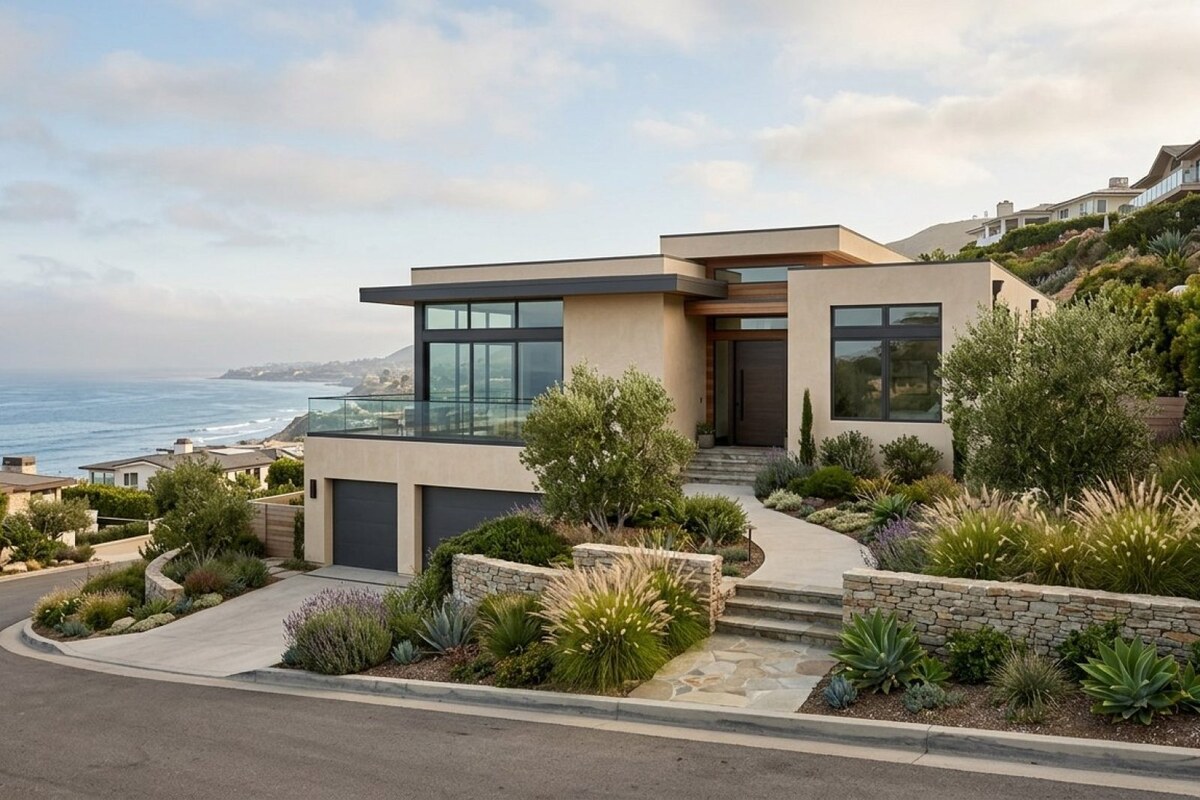
The 2022 map revision cycle repositioned boundaries in several coastal submarkets. In Orange County you'll encounter Very High FHSZ designations across Laguna Beach's canyon parcels, portions of Laguna Niguel adjacent to Aliso Wood, and Trabuco Canyon hillside lots abutting Cleveland National Forest. San Diego County's Very High zones extend through Rancho Santa Fe's eucalyptus corridors, Poway's eastern slopes, and Ramona's interface acreage. Malibu, Topanga, and the Pacific Palisades canyons in Los Angeles County remain persistently classified Very High, given chaparral density and Santa Ana wind exposure.
Three cost vectors emerge. Insurance premiums in Very High FHSZ can exceed baseline rates by a multiple, not a margin; I've seen coastal single-family rentals carry annual fire premiums that consume 80 to 120 basis points of property value where non-FHSZ comparables run 25 to 30. The California FAIR Plan, now functioning as primary coverage for thousands of properties that were previously in the admitted market, provides only dwelling fire coverage with restrictive sub-limits. Obtaining full replacement-cost protection requires layering a Difference in Conditions policy atop the FAIR Plan base, which effectively doubles the premium structure relative to a standard homeowners policy. Lenders now routinely audit coverage annually; loss of a policy mid-term can trigger technical default provisions or forced-place insurance at rates that destroy cash flow.
Properties in Very High Fire Hazard Severity Zones require a fundamentally different underwriting model. Insurance is no longer a fixed 25 to 30 basis points of property value; it becomes a variable cost that compresses net yield and narrows buyer pools at exit.
Public Resources Code § 4291 mandates 100 feet of defensible space encircling any structure within FHSZ, measured from the outermost projection of the building. The statute prescribes vegetation removal, fuel-load reduction, and ember-resistant plantings within that perimeter. Ongoing landscape maintenance to satisfy § 4291 typically requires a dedicated contractor; expect annual spend in the mid-four figures for a standard hillside lot, scaling upward with acreage and slope complexity. Non-compliance voids coverage in most policies and exposes the owner to county abatement liens if the fire marshal orders corrective work and the owner fails to execute within the statutory cure period.
Underwriting Wildfire Risk: Insurance, Reserves, and Exit Strategy
Investors who treat wildfire risk as a due-diligence checklist item rather than a permanent cost structure misunderstand the asset class. The correct approach starts with obtaining a bindable quote (not an indicative estimate) during the inspection period, then confirming that the property currently satisfies § 4291's defensible-space perimeter. Budget landscape maintenance as a recurring line item in the operating pro forma, not a one-time capital expense. Establish a reserve for ember-resistant retrofits: Class A composition roofing, dual-pane tempered glass, fiber-cement siding, and boxed eaves all reduce ignition probability and may qualify for premium credits with certain carriers. Stress-test your exit cap rate under the assumption that the next buyer will face insurance costs at least as high as yours, and possibly higher if carrier appetite continues to contract.
Very High FHSZ properties in coastal markets trade at wider cap rates than otherwise-identical parcels outside the zone, reflecting both the operating-expense burden and the reduced pool of qualified buyers willing to accept the risk. Investors acquiring these assets must either absorb the yield compression or execute hardening strategies (physical retrofits, multi-year insurance commitments, documented fuel-reduction programs) that credibly justify tighter exit pricing.
Flood Zone Disclosures: FEMA Maps and Mandatory Insurance
The NHD Statement identifies parcels within a Special Flood Hazard Area (SFHA), defined by FEMA as any zone where the annual exceedance probability equals or exceeds 1% (the statutory "100-year floodplain"). SFHA designations include Zone A (riverine flooding without established base flood elevation), Zone AE (riverine with surveyed BFE), and Zones V or VE (coastal velocity zones subject to wave action). Coastal California investors encounter SFHA primarily in bay-side communities, river estuaries, and parcels behind aging flood-control infrastructure.
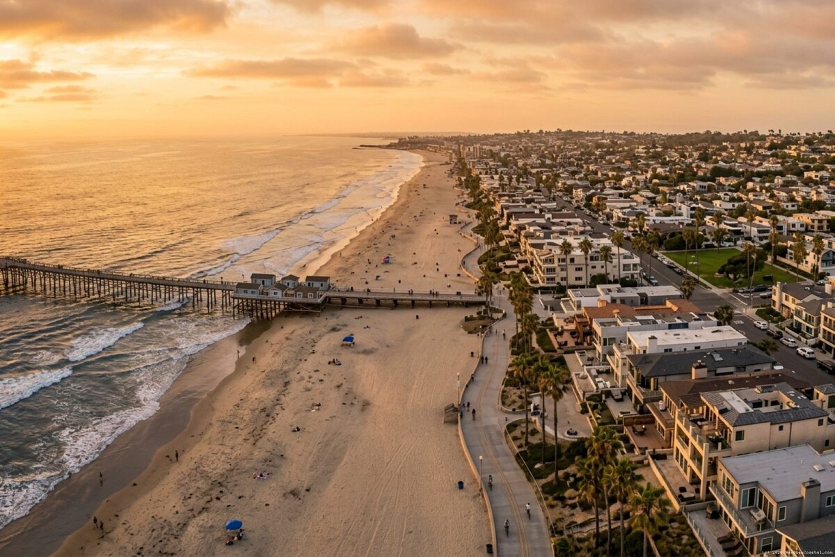
Orange County SFHA mapping extends through portions of Huntington Beach's inland blocks, Seal Beach near the San Gabriel River mouth, and segments of Newport Beach's Balboa Peninsula where storm surge and king tides converge. San Diego's SFHA inventory includes Mission Beach and Pacific Beach parcels adjacent to Mission Bay, plus Imperial Beach neighborhoods near the Tijuana River Estuary where binational drainage compounds flood exposure. In Los Angeles County you'll find SFHA designations in Marina del Rey's canal districts, Playa del Rey's wetland perimeter, and Long Beach coastal zones flanking the Los Angeles and San Gabriel river outlets.
Federal statute makes flood insurance mandatory for any property in SFHA securing a federally backed mortgage. The National Flood Insurance Program offers structural coverage capped at $250,000 and contents coverage capped at $100,000, per the Biggert-Waters Flood Insurance Reform Act of 2012 and subsequent amendments. Premiums reflect actuarial loss models keyed to base flood elevation, first-floor height, foundation type, and whether the structure predates the community's initial Flood Insurance Rate Map. Zone AE single-family rentals in coastal California generate annual NFIP premiums that vary widely based on elevation; I've observed quotes ranging from under $1,000 for an elevated slab-on-grade structure to north of $4,000 for a pre-FIRM home with a basement or below-grade garage. Zone V properties, where wave velocity is modeled, typically command higher premiums due to greater expected loss severity.
Properties valued above the NFIP cap require excess flood coverage from private carriers. A beachfront rental in Zone VE with a replacement cost of $3.5 million will need private excess coverage for the delta between $250,000 and $3.5 million; that excess layer can add several thousand dollars annually to the total flood insurance bill, materially compressing gross yield.
Elevation Certificates and LOMA Applications
An elevation certificate is a FEMA Form 086-0-33 survey that establishes the lowest adjacent grade, the lowest floor elevation, and (for certain foundation types) the top-of-bottom-floor elevation, all referenced to the community's vertical datum. Order the certificate during your inspection period for any parcel in or within 500 feet of an SFHA boundary. A licensed surveyor will complete the fieldwork and certify the elevations; turnaround typically runs two to three weeks. If the certified lowest floor exceeds the base flood elevation by one foot or more, you may qualify for a preferred-risk NFIP policy or a standard-rate policy with a lower premium tier.
Properties that fall within a mapped SFHA but sit on natural high ground above the base flood elevation can pursue a Letter of Map Amendment (LOMA), which formally removes the parcel from the SFHA designation. The LOMA application is filed online through FEMA's eLOMA portal at no charge, but it requires a certified elevation certificate and often a supporting topographic exhibit prepared by the surveyor. FEMA's review period averages 60 to 90 days. A successful LOMA eliminates the mandatory flood insurance requirement, which improves both operating cash flow and resale marketability by expanding the buyer pool to include those using conventional financing without flood-insurance overlays.
FEMA is midstream in remapping coastal California under the Risk Rating 2.0 methodology, which incorporates sea-level rise projections, updated storm-surge modeling, and LIDAR-derived topography. Preliminary Flood Insurance Rate Maps for several Orange County communities were released in late 2024; final adoption will follow the statutory comment and appeal period. Investors should assume SFHA boundaries may expand in the next map cycle, particularly in low-lying beach communities and areas protected by aging seawalls or levees. If you're acquiring a parcel currently outside SFHA but within a quarter-mile of the boundary, budget a flood-insurance contingency reserve in your underwriting model.
Earthquake Fault and Seismic Hazard Zones
California's Alquist-Priolo Earthquake Fault Zoning Act (Public Resources Code § 2621 et seq.) mandates disclosure of properties within designated fault zones, typically defined as a quarter-mile corridor straddling active fault traces. Alquist-Priolo zones trigger geotechnical investigation requirements for new construction or substantial structural alterations, but they impose no restrictions on existing improvements. For rental investors the disclosure is informational unless you plan ground-disturbing capital work.
More consequential are the Seismic Hazard Zones mapped under the Seismic Hazards Mapping Act (Public Resources Code § 2690 et seq.), which identify parcels susceptible to liquefaction or earthquake-induced landslides. Liquefaction zones predominate in bay-fill districts, river deltas, and reclaimed wetlands where saturated granular soils lose bearing capacity during seismic shaking. Coastal Orange County's harbor areas, San Diego's Mission Bay perimeter, and Los Angeles County's Marina del Rey and Long Beach flatlands all carry extensive liquefaction mapping. Landslide hazard zones appear on hillside parcels with steep gradients, ancient slide deposits, or weak bedrock; portions of Malibu, Palos Verdes, and Laguna Beach fall within this category.
The investor impact centers on earthquake insurance, which remains optional under California law but is increasingly required by lenders for properties in Seismic Hazard Zones or for loan amounts above institutional thresholds. The California Earthquake Authority offers coverage with deductibles that typically range from 15% to 25% of the dwelling limit, according to CEA's 2024 rate filings; annual premiums vary by construction type, soil conditions, and proximity to active faults. Private earthquake carriers provide lower deductibles (5% to 10%) but at premium costs that often exceed CEA by 30% to 50%.
Model earthquake insurance as optional but strategically valuable for properties in liquefaction zones, within Alquist-Priolo corridors, or on mapped landslide terrain. The decision depends on your leverage ratio, lender overlay requirements, and portfolio concentration. Investors holding multiple coastal California assets may rationally self-insure earthquake risk at the portfolio level rather than insuring each property individually, accepting the tail risk in exchange for the premium savings compounded across the portfolio.
Dam Inundation and Tsunami Zones
The NHD Statement discloses dam inundation zones, which delineate the area that would flood if an upstream impoundment failed. California's Division of Safety of Dams maintains inundation maps for all jurisdictional high-hazard dams; properties downstream of major reservoirs in Orange, San Diego, and Los Angeles counties may carry the designation. The practical risk is minimal (dam failure is a low-frequency event, and modern inspection protocols reduce the probability further), and standard homeowners policies typically cover flood damage resulting from dam failure, unlike riverine flooding which requires separate NFIP coverage.
Coastal parcels may also fall within tsunami inundation zones mapped by the California Geological Survey under its tsunami hazard assessment program. These zones extend inland from the shoreline based on probabilistic tsunami modeling calibrated to historic events and subduction-zone rupture scenarios. Tsunami zones appear on the NHD Statement in some counties but are not universally required by statute; check the CGS online mapping tool for the most current inundation polygons.
Tsunami risk does not trigger mandatory insurance, and standard flood policies exclude tsunami-generated flooding. Investors in beachfront or harbor-adjacent properties should familiarize themselves with local tsunami evacuation routes and consider the reputational implications of tsunami-zone designation, particularly for vacation-rental assets where guest perception of safety materially affects booking velocity and ADR.
Methane Gas and Other Special Hazards
Los Angeles County maintains methane gas hazard zones in areas with historic oil extraction, landfill deposits, or natural hydrocarbon seeps. Properties within methane zones may require soil-gas testing, vapor-barrier installation, and sub-slab ventilation systems to prevent methane accumulation in habitable spaces. The NHD Statement discloses methane zones where locally mapped; other counties (Orange, San Diego) have limited or no methane mapping.
Acquiring property in a methane zone introduces two friction points: potential construction costs for mitigation systems if you execute tenant improvements or substantial rehabilitation, and mandatory disclosure obligations to residential tenants under Health and Safety Code § 25220. Methane mitigation does not typically affect insurance pricing but can complicate financing (some lenders require third-party environmental clearance) and narrow the buyer pool at exit. Coastal Orange County has minimal methane exposure; Los Angeles County's coastal plain, particularly areas near historic oil fields in Long Beach, Torrance, El Segundo, and the Baldwin Hills, carries more extensive methane mapping per the county's Department of Public Works hazard maps published in 2018 and updated periodically.

NHD Due Diligence Checklist for Coastal Investors
Translating NHD disclosures into financial impact requires a systematic acquisition protocol. The following steps convert hazard data into underwriting inputs and risk-mitigation strategies:
- Order an independent NHD report during your inspection contingency period, even if the seller provides a report dated within the prior six months. Verify that the report reflects current CAL FIRE FHSZ maps (2022 vintage or later), the most recent FEMA FIRM panels, and updated CGS seismic hazard zones.
- Obtain bindable insurance quotes for fire, flood, and earthquake coverage keyed to the property's specific hazard designations. Require written binder commitments from carriers, not broker estimates; indicative quotes are insufficient for underwriting purposes.
- Request an elevation certificate for any parcel in SFHA or within 500 feet of an SFHA boundary. If the certified lowest floor exceeds base flood elevation, model the premium differential and evaluate a post-closing LOMA application to remove the SFHA designation permanently.
- Inspect defensible-space compliance for properties in Very High Fire Hazard Severity Zones. Walk the 100-foot perimeter required by Public Resources Code § 4291, photograph existing vegetation and fuel loads, and obtain a contractor bid for bringing the parcel into full compliance if the seller has deferred maintenance.
- Review municipal ordinances for hazard-related overlays that exceed state minimums. Some coastal cities impose stricter defensible-space rules (Laguna Beach requires 200 feet in certain canyon zones), mandate annual fire-department inspections with fees, or require seismic retrofitting for pre-1980 structures as a condition of rental-unit registration.
- Model insurance costs as variable line items in your operating pro forma. Use the actual quoted premiums you obtained during due diligence, not industry averages, and stress-test the impact of 10% and 20% annual premium escalation over your projected hold period.
- Establish dedicated capital reserves for hazard mitigation: ember-resistant roof replacement, window upgrades, drainage improvements, seismic foundation bracing. Factor these expenditures into your acquisition basis for cost-segregation and depreciation planning under IRC § 168.
- Assess exit liquidity by pulling comparable sales of similar properties in the same hazard zones over the trailing 24 months. Properties in Very High FHSZ or SFHA trade in narrower buyer pools and often at wider cap rates; calibrate your exit assumptions to actual transaction data, not to general-market pricing.
Insurance Market Dynamics: The 2025–2026 Coastal California Environment
California's property insurance market has contracted materially over the past 36 months, driven by wildfire loss severity, carrier exits from the state, and regulatory constraints that delayed rate increases through 2023. Several major admitted carriers (State Farm, Allstate, USAA) ceased writing new homeowners policies in California or non-renewed existing policies in elevated-risk ZIP codes. The California FAIR Plan, originally conceived as a temporary backstop for properties unable to obtain coverage in the voluntary market, now insures a policy count that has grown by over 40% since 2021, according to the plan's annual report to the Department of Insurance.
Three consequences matter for coastal investors. Lead times for binding coverage have extended; expect to engage a broker 30 to 45 days before your anticipated close rather than the historical 10 to 14 days. Premium increases are now routine in Very High FHSZ and SFHA, which necessitates dynamic expense modeling in your underwriting rather than static assumptions pegged to the seller's expiring policy. Coverage terms have narrowed across the market: higher deductibles (percentage-of-dwelling rather than flat-dollar), sub-limits on water damage and personal property, and outright exclusions for certain secondary structures are now standard in coastal policies.
Work with brokers who specialize in California coastal and high-hazard properties. These brokers maintain carrier relationships that general-market brokers lack and can structure layered coverage (FAIR Plan base plus DIC plus umbrella) that delivers full replacement-cost protection. In a constrained market, broker selection can generate material value.
FAIR Plan Strategies and Supplemental Coverage
The California FAIR Plan provides dwelling coverage for fire and a narrow set of named perils (lightning, explosion, aircraft, vehicles, riot, smoke). The plan does not cover theft, liability, water damage, or windstorm. Investors relying on FAIR Plan coverage must therefore purchase a Difference in Conditions (DIC) policy to cover the perils excluded by the base FAIR Plan policy. The combined FAIR Plan premium plus DIC premium typically exceeds the cost of a standard homeowners policy in the same location by 30% to 60%, based on quotes I've reviewed for coastal Orange County and San Diego County properties over the past 18 months.
The FAIR Plan is guaranteed-issue: the plan cannot decline an application if the property satisfies basic habitability standards (functional roof, code-compliant electrical and plumbing, no deferred structural maintenance). This makes the FAIR Plan a critical fallback for Very High FHSZ properties that cannot obtain coverage in the admitted market. However, FAIR Plan policies carry limitations: deductibles are higher than standard admitted-market policies (often 5% of dwelling coverage rather than $1,000 or $2,500 flat), coverage for detached structures is capped at 10% of dwelling coverage (versus 20% in most standard policies), and the plan does not offer automatic inflation adjustments, requiring annual manual increases to maintain adequate replacement-cost coverage.
Model FAIR Plan plus DIC as your baseline insurance cost for Very High FHSZ properties and treat any admitted-market quote as a favorable variance. This conservative approach prevents underwriting surprises and produces pro formas that reflect realistic operating costs rather than optimistic assumptions.
Lender Requirements and Hazard Zone Financing
Lenders have layered additional underwriting overlays onto properties in NHD-disclosed hazard zones. Common requirements now include: proof of full-replacement-cost insurance at loan origination and annually thereafter (with the lender named as loss payee and mortgagee), mandatory flood insurance for any property in SFHA regardless of loan-to-value ratio, earthquake insurance for loans above certain dollar thresholds or for properties in Seismic Hazard Zones, and loan-to-value caps (often 75% rather than 80%) for properties in Very High Fire Hazard Severity Zones.
Some lenders have withdrawn entirely from Very High FHSZ lending, narrowing the financing universe for investors. Pre-qualify your lender during the inspection period and obtain written confirmation that the lender will accept the specific property in its specific hazard-zone configuration. Generic representations that the lender "finances California rental properties" are insufficient; you need underwriting approval tied to the subject parcel's FHSZ, SFHA, and seismic-zone designations.
Debt service coverage ratio requirements have also crept upward for hazard-zone properties. Where a lender might accept 1.20× DSCR for a non-hazard-zone asset, the same lender may require 1.30× or 1.35× DSCR for a Very High FHSZ property, reflecting both the elevated operating expense and the perceived exit risk. Model DSCR at the lender's actual requirement for the subject property, not at generic market standards.
Portfolio-Level Risk Management for Multi-Property Investors
Investors holding multiple coastal California properties should evaluate hazard exposure at the portfolio level, not merely asset by asset. A portfolio concentrated in Very High FHSZ or SFHA faces correlated risk: a single wildfire season or atmospheric river event can damage multiple properties simultaneously, straining both liquidity and insurance capacity.
Portfolio risk management strategies worth considering include: geographic diversification across hazard zones (balance Very High FHSZ hillside acquisitions with non-FHSZ urban infill assets in the same metropolitan area), staggering insurance renewal dates to avoid simultaneous premium shocks across the portfolio in a single calendar quarter, establishing a portfolio-level capital reserve for hazard mitigation and emergency repairs that can be deployed flexibly across assets, and exploring portfolio-level insurance solutions such as blanket policies or aggregate deductibles that may offer better pricing than individual property policies for investors with five or more properties.
Model portfolio-level exit scenarios as well. If insurance costs continue rising or lender appetite for hazard-zone properties contracts further, you may need to exit multiple properties within a compressed timeframe to rebalance portfolio risk or satisfy lender covenants. Pre-identifying potential buyers (other investors with hazard-zone mandates, 1031 exchange buyers seeking specific geographies, or institutional funds with risk-adjusted return targets that accommodate hazard zones) reduces execution risk and preserves optionality.
Regulatory Outlook: What's Coming in 2026–2027
California's regulatory framework for natural hazard disclosure and mitigation continues to evolve. Several legislative and administrative initiatives will affect coastal investors over the next 18 to 24 months:
- AB 38 (2024) directs the California Department of Insurance to establish a Sustainable Insurance Strategy, including potential rate reforms, wildfire mitigation incentives, and carrier participation requirements. Implementation regulations are expected in late 2026; early drafts suggest premium credits for properties with documented fire-hardening retrofits and defensible-space maintenance programs.
- SB 894 (2024) expands the California FAIR Plan's coverage limits from $3 million to $6 million effective January 1, 2026, and authorizes the plan to offer limited liability coverage, which will reduce reliance on separate DIC policies for some investors.
- CAL FIRE's periodic FHSZ map updates will incorporate updated fuel models, climate projections, and fire history from the 2020–2024 fire seasons. Preliminary indications from CAL FIRE's public workshops suggest that Very High FHSZ boundaries may expand in certain Orange County foothill areas and San Diego County backcountry zones.
- FEMA's Risk Rating 2.0 flood map updates are progressing through coastal California; several communities received Preliminary Flood Insurance Rate Maps in 2024 and will finalize adoption in 2026. The new maps incorporate sea-level rise, updated storm-surge modeling, and LIDAR topography, which may expand SFHA boundaries in low-lying coastal areas.
- Local defensible-space ordinances continue to proliferate. Laguna Beach, Malibu, and portions of the City of San Diego have adopted vegetation-management rules that exceed state Public Resources Code § 4291 standards, imposing 200-foot perimeters or requiring annual fire-department inspections with associated fees. Investors must track ordinances jurisdiction by jurisdiction.
The regulatory trajectory points toward greater disclosure, stricter mitigation standards, and higher compliance costs for properties in hazard zones. Investors who develop hazard-zone fluency now (understanding the maps, the insurance market, the mitigation pathways) will hold a competitive advantage as the regulatory environment tightens.
Actionable Strategies for Hazard-Zone Acquisitions
Coastal investors can still generate attractive risk-adjusted returns in hazard-zone properties by deploying targeted strategies that mitigate risk and capture embedded value:
- Target properties with recent mitigation work. Homes with Class A composition roofing, ember-resistant attic vents, dual-pane tempered windows, and compliant defensible space command premium rents relative to non-mitigated comparables and trade at tighter cap rates. Acquire these properties at a discount to replacement cost and capture the embedded mitigation value through lower insurance premiums and stronger resale pricing.
- Execute value-add mitigation. Acquire Very High FHSZ properties with deferred maintenance or outdated fire protection, invest capital in fire-hardening improvements (roof, windows, siding, landscaping), and reposition the asset as a lower-insurance-cost rental. The mitigation expenditure can be recoverable through reduced annual premiums and higher exit valuation, particularly if you document the work and obtain premium credits from the carrier.
- Pursue LOMA applications aggressively. For properties near SFHA boundaries, order elevation certificates during due diligence and file LOMA applications immediately upon identifying eligible parcels. Removing the SFHA designation eliminates the mandatory flood-insurance requirement, which improves cash flow and expands the buyer pool at exit by opening the property to conventional financing without flood-insurance overlays.
- Underwrite insurance as a variable expense with upward bias. Model potential premium increases of 5% to 10% annually over your hold period and stress-test cash flow at those levels. Properties that generate acceptable returns only at today's insurance costs are not investable in the current market.
- Build lender relationships early. Identify portfolio lenders, regional credit unions, and DSCR lenders who actively finance hazard-zone properties. Pre-qualify properties during the inspection period and lock rate commitments before entering contract, particularly for Very High FHSZ acquisitions where lender appetite is narrower.
- Apply cost segregation to mitigation spend. Fire-hardening improvements (roofing, windows, site landscaping, drainage systems) often qualify for accelerated depreciation under a cost-segregation study. The tax benefit offsets part of the mitigation cost and improves after-tax returns; engage a qualified cost-segregation firm during the first twelve months of ownership to maximize the deduction.
The investors who master NHD underwriting in 2026 will be the ones capturing value in coastal California's next cycle, because hazard-zone properties are mispriced by sellers who don't understand the insurance burden and undervalued by buyers who don't know how to mitigate the risk.
Conclusion: NHD as a Competitive Advantage
California's Natural Hazard Disclosure Statement has migrated from a routine closing document to a primary underwriting tool that shapes acquisition decisions, operating budgets, and exit strategies. For coastal investors in 2026, fluency in NHD analysis (understanding wildfire severity zones, flood maps, earthquake hazards, and the insurance implications of each) represents a competitive advantage in a market where many participants still treat the disclosure as perfunctory.
Properties in Very High Fire Hazard Severity Zones and Special Flood Hazard Areas are not categorically uninvestable. They require different underwriting assumptions, higher capital reserves, and active ongoing risk management. Investors who build expertise in hazard-zone acquisitions, cultivate relationships with specialized insurance brokers and lenders who understand the risk profile, and execute targeted mitigation strategies will find opportunities that less-informed capital overlooks.
The coastal California rental market remains fundamentally strong. Demand is deep, supply is constrained by land-use regulation and construction costs, and rent growth in most submarkets continues to outpace CPI. Hazard-zone properties participate in that growth, but they demand investors who understand the NHD framework and can translate disclosure data into actionable investment decisions. The investors who began building that expertise in 2024 and 2025 are the ones capturing value today, while others are still learning to read the maps.
Frequently Asked Questions
Is the Natural Hazard Disclosure Statement required for all California real estate transactions?
How much does flood insurance cost for a property in a FEMA Special Flood Hazard Area?
Can I remove my property from a FEMA flood zone?
What is the California FAIR Plan and when should investors use it?
How do lenders treat properties in Very High Fire Hazard Severity Zones?
What is defensible space and how much does it cost to maintain?